


Cascades Ruitor

schweizs
User
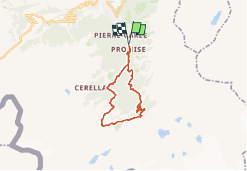

Length
12.5 km

Max alt
2221 m

Uphill gradient
841 m
Km-Effort
24 km

Min alt
1510 m

Downhill gradient
841 m
Boucle
Yes
Creation date :
2024-07-14 08:47:36.744
Updated on :
2024-07-15 16:59:08.345
4h12
Difficulty : Very difficult

FREE GPS app for hiking
 SityTrail
IGN / Geographical institutes
SityTrail Plus
The world is yours!
About
Trail Walking of 12.5 km to be discovered at Aosta Valley, Unknown, La Thuile. This trail is proposed by schweizs.
Positioning
Country:
Italy
Region :
Aosta Valley
Department/Province :
Unknown
Municipality :
La Thuile
Location:
Unknown
Start:(Dec)
Start:(UTM)
341260 ; 5062655 (32T) N.
Comments